Portfolio of Long Point Harbour

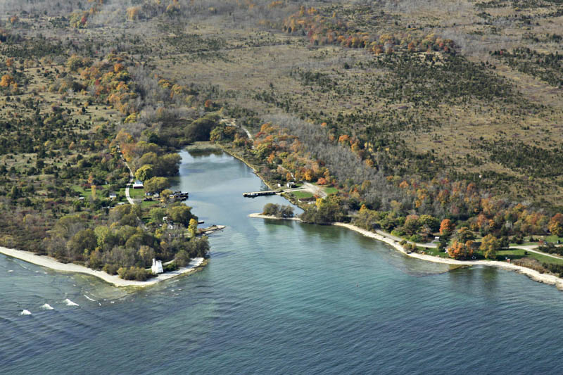
Long Point Harbour is at the extreme southeastern tip of the county, at the end of Prince Edward Point. The False Duck Islands, Timber on the left and Swetman to the right, emerge from a ridge of shoals running across Lake Ontario. This view looks east towards Main Duck Island and Kingston. The little harbour was formed by wave erosion from a fault line or crack in the sedimentary bedrock. A lighthouse is also located on the point.
Darko Zeljkovic photo
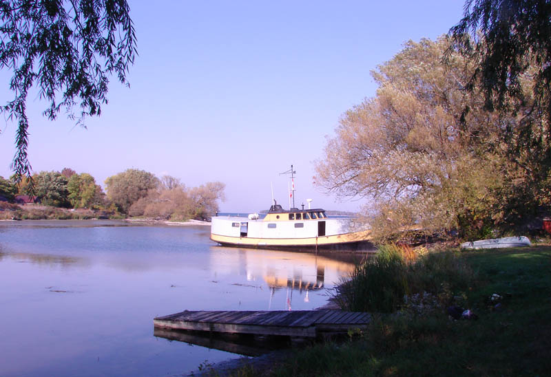
A fishing boat in Long Point Harbour.
Orland French photo
A view of Long Point Harbour and lighthouse.
Darlene Shantz/Prince Edward Stewardship Council photo

Photographer Joe Vanveenen stands on the smooth limestone rocks sloping into Lake Ontario at Long Point.
Orland French photo

The old lighthouse at Long Point is peeling and rotting away among the undergrowth near Long Point Harbour. It has been replaced with a modern steel tower.
Orland French photo

Rotted wooden siding is falling off the old lighthouse, showing a layer of shingles underneath.
Orland French photo
Long Point Harbour is at the extreme southeastern tip of the county, at the end of Prince Edward Point. The False Duck Islands, Timber on the left and Swetman to the right, emerge from a ridge of shoals running across Lake Ontario. This view looks east towards Main Duck Island and Kingston. The little harbour was formed by wave erosion from a fault line or crack in the sedimentary bedrock. A lighthouse is also located on the point.
Darko Zeljkovic photo
A fishing boat in Long Point Harbour.
Orland French photo
A view of Long Point Harbour and lighthouse.
Darlene Shantz/Prince Edward Stewardship Council photo
Photographer Joe Vanveenen stands on the smooth limestone rocks sloping into Lake Ontario at Long Point.
Orland French photo
The old lighthouse at Long Point is peeling and rotting away among the undergrowth near Long Point Harbour. It has been replaced with a modern steel tower.
Orland French photo
Rotted wooden siding is falling off the old lighthouse, showing a layer of shingles underneath.
Orland French photo